We made it!!!
We arrived around 2:00 p.m. local time, hooked up with a buddy of ours up here and tooled around town and the surrounding areas for a few hours. It is just breathtakingly gorgeous and it quickly became apparent that we've made the right choice. The population is around 74,000, and everything you need is right in town, but conspicuously absent is the "strip malls and condos" look that's become all too common these days... it looks very small town even though it's not. There are trees everywhere, lakes and rivers all around, beautiful old architecture, clean streets, and really delicious food. The Trent-Severn Waterway runs right through town. There are tons of cabins and cottages right on its shores. Many houses and apartments are tucked away so you'd never know there were homes back there, except for a mailbox in front or a small break in the trees revealing a gorgeous tree-lined dirt road leading back to somewhere, and frequently they too are on the shore of the waterway or one of the lakes.
This place is so amazing! It's like a storybook fantasy. Honestly, I didn't know places like this existed anywhere other than books. When our friend told me about this place, a part of me wondered if he might be a little biased, or remembering things a bit better than they were. This is not the case. We were astounded by the sheer beauty of this place. It felt surreal to drive around and take it all in... our immigration process complete, our long drive at its end, and marveling at this place that was well worth every penny, every mile, and every moment of time expended to get here.
Tonight was the last night of the Peterborough Festival of Lights, a series of free outdoor concerts followed by fireworks, held twice a week all summer long. After dropping off our friend, passing the park on the way to our hotel, we heard the strains of "O Canada" for the first time since crossing the border... and knew that we were home.
Saturday, August 25, 2007
Friday, August 24, 2007
Sault Ste. Marie, Ontario
This is right at the Canada-U.S. border and there is also a Sault Ste. Marie, Michigan across the river. The two cities are connected by the Sault Ste. Marie International Bridge. The name comes from archaic French for "Saint Mary's Falls," but the pronunciation has been anglicised to "Sue sent Marie."
BACKPOSTING POINT
This is the start of some backposting, the point where I left off when I started feeling too sick to sort and post the rest of the photos. We've been sick for over a year now but are slowly recovering. It is now Oct 2008 and I hope to get everything caught up. I'll leave this message here as a reference point for you to know roughly where the old old pics end and the new old pics begin.
Lake Superior Provincial Park, Ontario - Trapper's Trail
When we got here there were two rangers from Parks Canada hacking at a beaver dam with axes. I got curious and asked them why. They informed me that they normally leave them alone, but this particular dam had caused some flooding on a trail back there. It was only after 10 minutes of heading down a trail in a different direction, as it got slushier and slushier, that I realized that this trail and that trail were one and the same. (It follows the shore of Rustle Lake.) Oooops.
This dam thing is broken

A dam shame

Rustle Lake


More of Rustle Lake

This is about how the trail looked when we decided, hmm, maybe we'd better turn back.

This dam thing is broken

A dam shame

Rustle Lake


More of Rustle Lake

This is about how the trail looked when we decided, hmm, maybe we'd better turn back.

Lake Superior Provincial Park, Ontario - Old Woman Bay
Two chipmunks chased each other in circles all around the parking lot, then found a sandwich and took off with it. I managed to snap this before they disappeared. (lower right corner)


The cliffs that give Old Woman Bay its name


The cliffs that give Old Woman Bay its name

Wawa, Ontario
The name Wawa came from "wawagonk," an Ojibway name for a local lake, meaning "place of clear water." Wawa is said to have then been mistranslated to wild goose instead of "wewe," meaning "snow goose."
Wawa is in fact on a major migratory flyway from southeastern North America to Hudson's Bay and the Arctic. Each spring and fall, the familiar V-shaped flocks of Canada geese return to their traditional feeding grounds.
Wawa has Canada geese symbols everywhere:
Neon ones all along the main drive

On a restaurant

Marking local stores

And a big huge one, as you enter Wawa from the Trans Canada Highway. This monument was dedicated to commemorate the opening of the last link of the Trans-Canada Highway, as it was finally completed in 1960, linking Wawa to Sault Ste. Marie and Western Canada.

Nickie became startled by this large goose and made a run for the border. (She came back after I explained to her that she will not be in Mexico if she does this.)

A nice view of the aforementioned Trans Canada Highway, and Lake Superior to the left

Thursday, August 23, 2007
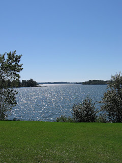
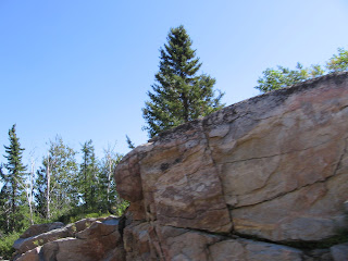
Lake Superior, Ontario
A bird soars over the clifftop. Layers of colours streak across the rock formations, contrasted against the bushy trees and a lacy veil of clouds making its way across a smooth blue sky. I just love the textures and shapes in this pic! So I was really disappointed to find some odd pixellating along the lower left side. Data loss? Ah well...

This pic really doesn't do justice to the beautiful red, orange, yellow, white and tan layers of rock that can be seen out here.

Nickie looking out over Lake Superior


This pic really doesn't do justice to the beautiful red, orange, yellow, white and tan layers of rock that can be seen out here.

Nickie looking out over Lake Superior


Thunder Bay, Ontario - Terry Fox Monument
Terrance Stanley "Terry" Fox (1958-1981) was a Canadian humanitarian, athlete, and cancer treatment activist. He is considered a true Canadian hero. After losing his right leg to bone cancer, he began training with a prosthetic leg and decided to raise money for cancer research by running a Marathon of Hope across the country. His goal was to raise $1 for every Canadian man, woman, and child (about 22 million at the time) for cancer research.
He planned to run about 42 kilometres (26.2 miles) per day, the distance of a typical marathon, for a total of 5,300 miles. He dipped his artificial foot in the Atlantic Ocean at St. John's, Newfoundland and planned to dip it into the Pacific Ocean in Victoria, British Columbia. He stopped at points along the way to talk to people and spread a message of hope. He ran 5,373 kilometres (3,339 miles, or about 23.3 miles per day) through Newfoundland, Nova Scotia, Prince Edward Island, New Brunswick, Quebec, and part of Ontario, past the halfway mark. But just northeast of Thunder Bay, he was forced to stop due to chest pains and breathing problems. The cancer had spread to his lungs. The fundraising continued, however, and his goal was surpassed as $24.17 million was raised. Isadore Sharp, president of the Four Seasons Hotel, wrote Terry saying his dream would continue with an annual fundraising marathon, to be called the Terry Fox Run. This noncompetitive run is conducted all over the world every September, and it is the world's largest one-day fundraiser for cancer research.
To Canadians, Terry Fox is an inspiring example of courage, determination, selflessness, strength of the human spirit, striving to make things better, and the difference one person can make. He has been honoured with a whole slew of awards, both before and after his death in 1981, and tens of millions of dollars have been raised in his name for research to improve cancer detection and find a cure.


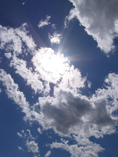
Ignace, Ontario - cool cloud cover
I couldn't resist taking these. The clouds made the sun look so dramatic, and little snippets of brilliant blue sky peeked through from behind them.


Thunder Bay, Ontario
Guess the rest of the blog catching-up will likely end up being done when we reach our destination of Peterborough. There is just too much to squeeze into each day! We'll see how I feel in the morning. Well, it's 12:27 AM now but you know what I mean.
Ontario is a huge province, especially if you're heading east or west across it (which the majority of people are). If you thought we must be close to our destination because we're already in Ontario, you'd be wrong. I reminded Nickie that when we hit the Ontario border we'd only be about 2/3 of the way through our trip.
Ontario is a huge province, especially if you're heading east or west across it (which the majority of people are). If you thought we must be close to our destination because we're already in Ontario, you'd be wrong. I reminded Nickie that when we hit the Ontario border we'd only be about 2/3 of the way through our trip.
Wednesday, August 22, 2007
Kakabeka Falls, Ontario
The name Kakabeka comes from an Ojibway word meaning "thundering water." The Falls are 69 metres (225 feet) wide and plunge 39 metres (128 feet) into a Precambrian Shield gorge. In Ontario, Kakabeka Falls are second only to Niagara Falls, and are often considered the Niagara Falls of the north.


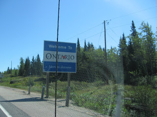
Ontario
The name Ontario is derived from an Iroquoian word, although exactly which word and which meaning it came from is of some debate:
kanadario - sparkling or beautiful water
onitariio - beautiful lake
skanadario - very pretty lake
one of the above, but meaning only "a large body of water"
Manitoba-Ontario border. Almost there - not! hehe
It's amazing that there are so many trees in this part of the continent. As you can see by this cutaway next to the highway, there's only a very thin layer of soil covering endless miles of bedrock.

kanadario - sparkling or beautiful water
onitariio - beautiful lake
skanadario - very pretty lake
one of the above, but meaning only "a large body of water"
Manitoba-Ontario border. Almost there - not! hehe


It's amazing that there are so many trees in this part of the continent. As you can see by this cutaway next to the highway, there's only a very thin layer of soil covering endless miles of bedrock.


Whiteshell Provincial Park, Manitoba
Maple syrup. Maple cream cookies. Maple taffy. Maple candies. Yummm!!

Whiteshell Provincial Park, Manitoba
Campin' out


We enjoyed a lovely breakfast outside on this quiet, peaceful, cool and crisp morning. Ahhhhhhh.


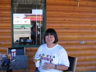


We enjoyed a lovely breakfast outside on this quiet, peaceful, cool and crisp morning. Ahhhhhhh.


Tuesday, August 21, 2007
Whiteshell Provincial Park, Manitoba
The Lily Pond


We started seeing lots of deer!

Mama and baby


Next 2 pics - another mama and baby

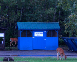


We started seeing lots of deer!

Mama and baby


Next 2 pics - another mama and baby


Subscribe to:
Posts (Atom)
